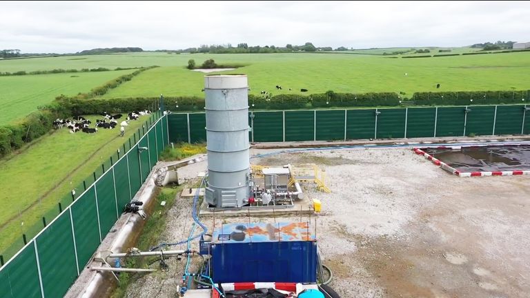
People in England can find out if fracking could come to their area by entering their postcode in a new interactive map, which illustrates the regions covered by oil and gas licences.
Over a quarter of local authorities are covered by existing licences to explore for oil and gas, which could involve fracking, according to new analysis by campaigners Friends of the Earth, which developed the tool.
Prime Minister Liz Truss has pledged to lift the ban on fracking – imposed in 2019 after a public outcry over minor earthquakes – to exploit England’s “huge reserves of shale”.
Further detail on the lifting of the moratorium, and whether the government will relax rules around earthquake levels and planning, is expected in the coming days.
A leaked copy of a review to assess progress on the safety of the practice admits that forecasting earthquakes related to fracking “remains a scientific challenge,” according to The Guardian.
Campaigners have been calling for the publication of the report, which was delivered to the business and energy department on 5 July, just before Boris Johnson’s resignation as PM announcement threw the government into disarray.
A new licencing round is on the horizon amid the new government’s fracking drive to boost energy security.
‘Fantasy land’
The new prime minister claims gas could start flowing in fewer than six months, but experts say it would take years, is very difficult to access and would have little impact on energy bills.
“Energy security is important,” Friends of the Earth campaigner Danny Gross told Sky News. But fracking’s unpopularity and England’s geological limitations mean the government is “living in a fantasy land if it thinks that fracking is the answer,” he said.
Ms Truss, a former industrial economist for Shell, has promised her fracking drive will take place where there is “local support”.
But the most recent government polling finds just 17% of the public supported fracking in autumn 2021, compared with 87% who supported renewable energy.
The best way to reduce gas imports is by reducing “our dependency on using gas,” Mr Gross added.
“And the way to do that is to insulate homes, so that we don’t need so much gas to heat [them],” as well as investing in renewable energy and unblocking restrictions on onshore onshore wind and solar, he said.
A Government spokesperson insisted utilising domestic gas resources “makes us less dependent on imports” and helps “maintain the security of the UK’s energy supply in both the short and long-term”.
They said it would be done “as safely as possible and where there is local support.”
The industry says fracking will boost jobs as well as supply.
Many of the licences cover the Bowland Shale Formation, of particular interest for the fracking industry, which spans across the Midlands and the North of England.
Five local authorities have licences covering their entire area: Blackpool, Fylde, Mansfield, Bolsover and Chesterfield.
Existing onshore oil and gas licences cover land in 91 of 333 local authorities in England, listed below. The numbers represent the percentage of land covered by a licence.
Amber Valley 9.80%
Arun 2.00%
Ashfield 86.60%
Barnsley 58.50%
Basingstoke and Deane 7.30%
Bassetlaw 69.00%
Blackburn with Darwen 40.60%
Blackpool 100.00%
Bolsover 100.00%
Bolton 1.10%
Bournemouth, Christchurch and Poole 56.60%
Broxtowe 1.60%
Charnwood 6.20%
Cheshire East 47.60%
Cheshire West and Chester 79.70%
Chesterfield 100.00%
Chichester 31.30%
Chorley 79.30%
Crawley 22.10%
Derbyshire Dales 1.60%
Doncaster 82.30%
Dorset 24.40%
East Hampshire 8.70%
East Lindsey 16.30%
East Riding of Yorkshire 70.60%
Erewash 0.60%
Fylde 100.00%
Gedling 35.70%
Guildford 3.80%
Halton 81.50%
Hambleton 9.00%
Hart 18.60%
Havant 5.80%
Horsham 21.20%
Kingston upon Hull, City of 1.20%
Knowsley 26.20%
Lancaster 1.40%
Leeds 0.20%
Lewes 6.10%
Lincoln 49.60%
Liverpool 12.80%
Manchester 1.30%
Mansfield 100.00%
Melton 4.80%
Mid Sussex 30.20%
Middlesbrough 0.30%
Mole Valley 20.30%
Newark and Sherwood 22.30%
Newcastle-under-Lyme 8.90%
North East Derbyshire 87.10%
North East Lincolnshire 57.20%
North Kesteven 6.50%
North Lincolnshire 22.40%
North Somerset 25.20%
Nottingham 1.10%
Preston 89.20%
Redcar and Cleveland 12.30%
Reigate and Banstead 36.50%
Ribble Valley 0.90%
Rotherham 89.20%
Rushcliffe 34.10%
Ryedale 84.10%
Salford 45.80%
Scarborough 44.60%
Sedgemoor 37.10%
Sefton 78.70%
Selby 21.40%
Sevenoaks 4.60%
Sheffield 48.80%
Shropshire 0.20%
Somerset West and Taunton 8.20%
South Ribble 94.90%
St. Helens 41.60%
Stafford 1.50%
Staffordshire Moorlands 5.80%
Stockton-on-Tees 2.40%
Stoke-on-Trent 59.80%
Tandridge 44.80%
Test Valley 20.50%
Trafford 89.00%
Wakefield 54.70%
Warrington 98.30%
Waverley 41.90%
Wealden 0.40%
West Lancashire 99.50%
West Lindsey 54.80%
Wigan 65.50%
Winchester 14.10%
Wirral 54.60%
Wyre 78.10%
York 38.40%

